")
")
In this section, the overview and property description of Wat Phra Mahathat Woramahawihan, Nakhon Si Thammarat in peninsular Thailand will be provided.
- Overview of Wat Phra Mahathat Woramahawihan, Nakhon Si Thammarat
Wat Phra Mahathat Woramahawihan, Nakhon Si Thammarat (Phra Mahathat Monastery of Nakhon Si Thammarat) is an outstanding and continuing testimony to the deep-rooted religious interchanges across the south of maritime Asia for around 1,500 years. Located in peninsular Thailand, serving as a crucial link of maritime trade and social interaction between the Indian and Pacific Oceans, this currently vibrant Theravada Buddhist monastery has historically captured the major religious and architectural influences, including those related to Brahmanism/Hinduism, Mahayana, and Theravada Buddhism, from diverse places, such as northeast India, central Java (Indonesia), Sri Lanka, and the Mon region of southern Myanmar. No other living World Heritage temples in South and Southeast Asia have demonstrated this high level of religious and architectural diversity, longevity, and continuity.
The main attributes and their associated intangible heritage which embody the potential Outstanding Universal Value (Criteria (ii) and (vi)) of Wat Phra Mahathat include:
- Landscape and setting of the monastery
- Monuments and their associated artworks
- Nakhon Si Thammarat chronicle tradition
- Living traditions
- Site Description
The attributes and their associated elements demonstrating the Outstanding Universal Value of this property will be described in this section as follows:
Landscape and Setting
Wat Phra Mahathat is situated in Nakhon Si Thammarat Province on the east coast of peninsular Thailand, an improbable thin ribbon of land between the vast Indian and Pacific Oceans and a crucial link of trade and social interaction in maritime Asia. Nakhon Si Thammarat was also an old kingdom dated to around the 12th-14th century CE, historically considered the successor of the ancient kingdom Tambralinga (c. the 5th-11th centuries), which was mentioned in the Indian text around the 2nd century CE already as a placename in the maritime trade network. Both kingdoms were located in the same coastal land on ancient beach ridges, formed around 6,000-8,000 years ago during the maximum transgression of sea water. These sandy beach ridges, running in the north-south direction parallel to the present shoreline of the Gulf of Siam, are the core of the settlement pattern in this area, because they are high grounds and not easily flooded in the rainy seasons. People still use these ancient beach ridges to commute between many towns and communities in this coastal land.
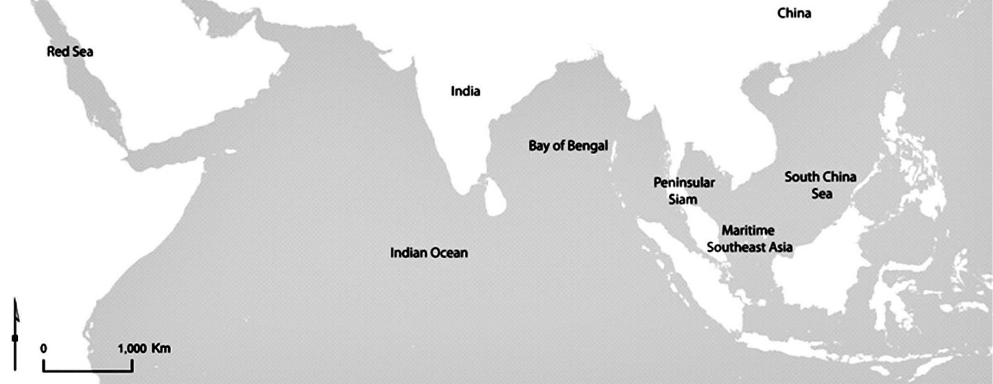
Plan 2-1 Southern Maritime Asia and Peninsular Siam (Thailand)
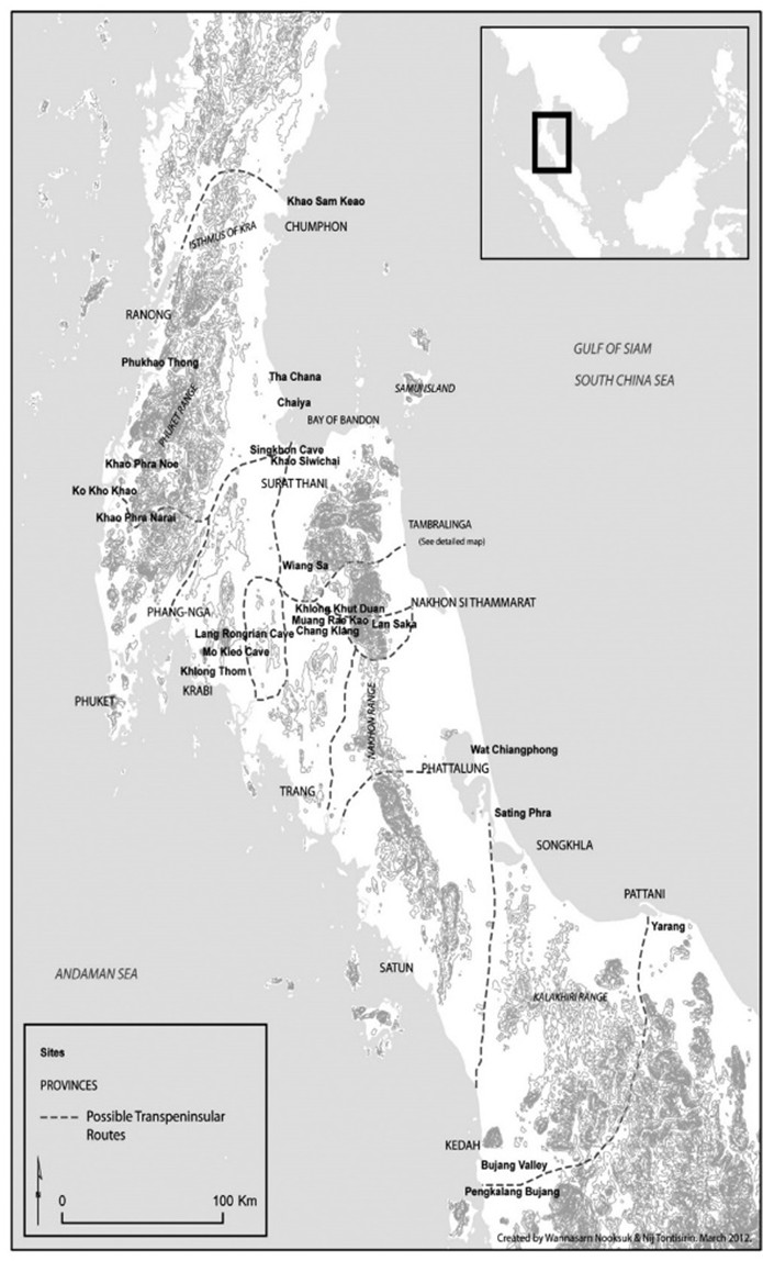
Plan 2-2 Peninsular Thailand, Provinces, Possible Trans-Peninsular Routes, and Related Archaeological Sites
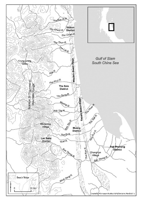
Plan 2-3 Geography of Coastal Nakhon Si Thammarat, the Heartland of Tambralinga/ Nakhon Si Thammarat
The shapes of the historic urban area of Nakhon Si Thammarat and its Wat Phra Mahathat are elongated, running in the north-south directionality due to the long, narrow characteristic of the ancient beach ridge. There are a series of rivers connecting this area to the mountains, rice plains, and sea. In fact, there are at least two walled, moated towns in this historic area, including Phra Wiang and Nakhon Si Thammarat Towns, whose names are mentioned in the local chronicles. These walled cities are still visible today. Phra Wiang Town has earthen walls, which are rectangular with rounded corners, while Nakhon Si Thammarat Town is much elongated and has brick walls, rectangular with sharp corners, probably built in the 15th century and subsequently renovated in the Ayutthaya period. Some sections of the monumental brick walls are maintained in the northern end of the town, especially at the Sanam Na Mueang Park.
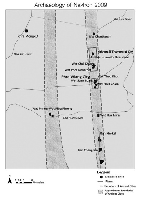
Plan 2-4 Nakhon Si Thammarat and Phra Wiang Towns and Excavated Sites in 2009
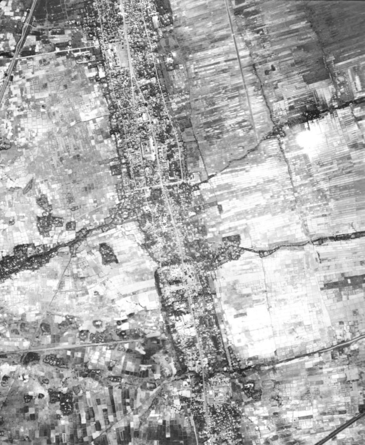
Fig. 2.1 Aerial photograph taken in the 1970’s of Nakhon Si Thammarat Town in the north and Phra Wiang Town in the south
Wat Phra Mahathat is located in the southern part of Nakhon Si Thammarat Town, inside the Town’s brick walls and has served as the religious center of this Old Town. Historically in Thailand, especially from the Ayutthaya period (from around 15th century onwards), important towns would have their central reliquaries, believed to enshrine the Buddha’s relics. Wat Phra Mahathat’s Great Reliquary is considered one of the most outstanding examples of this remarkable tradition and is still a vibrant monastery, indeed very rare in today’s context.
The ancient beach ridge, serving as the core of the landscape of the Old Town, makes Nakhon Si Thammarat and Wat Phra Mahathat unique. The local chronicles call this ridge “the Crystal Beach” because of its pure, white sand and describe its sacredness in length. According to the local chronicles, it was this Crystal Beach under which the relics of the Buddha was buried by Indian royal siblings and was later discovered by a righteous Buddhist king who erected the Great Reliquary before founding his capital and kingdom of Nakhon Si Thammarat. The central place of the Crystal Beach and Great Reliquary in the local chronicles and living memories of people is exceptional in Southeast Asia. The Great Reliquary is also the official emblem of Nakhon Si Thammarat Provincial Government, appearing at the center surrounded by 12 zodiac animals, representing Nakhon Si Thammarat’s tributary cities all over the Thai-Malay Peninsula, noted in the local chronicles. Today, the Crystal Beach is still attentively preserved in the form of a broad sand ground in front of the Great Reliquary, creating a remarkable landscape and scenery with immense historical significance, which cannot be found anywhere else in the urban area anymore.
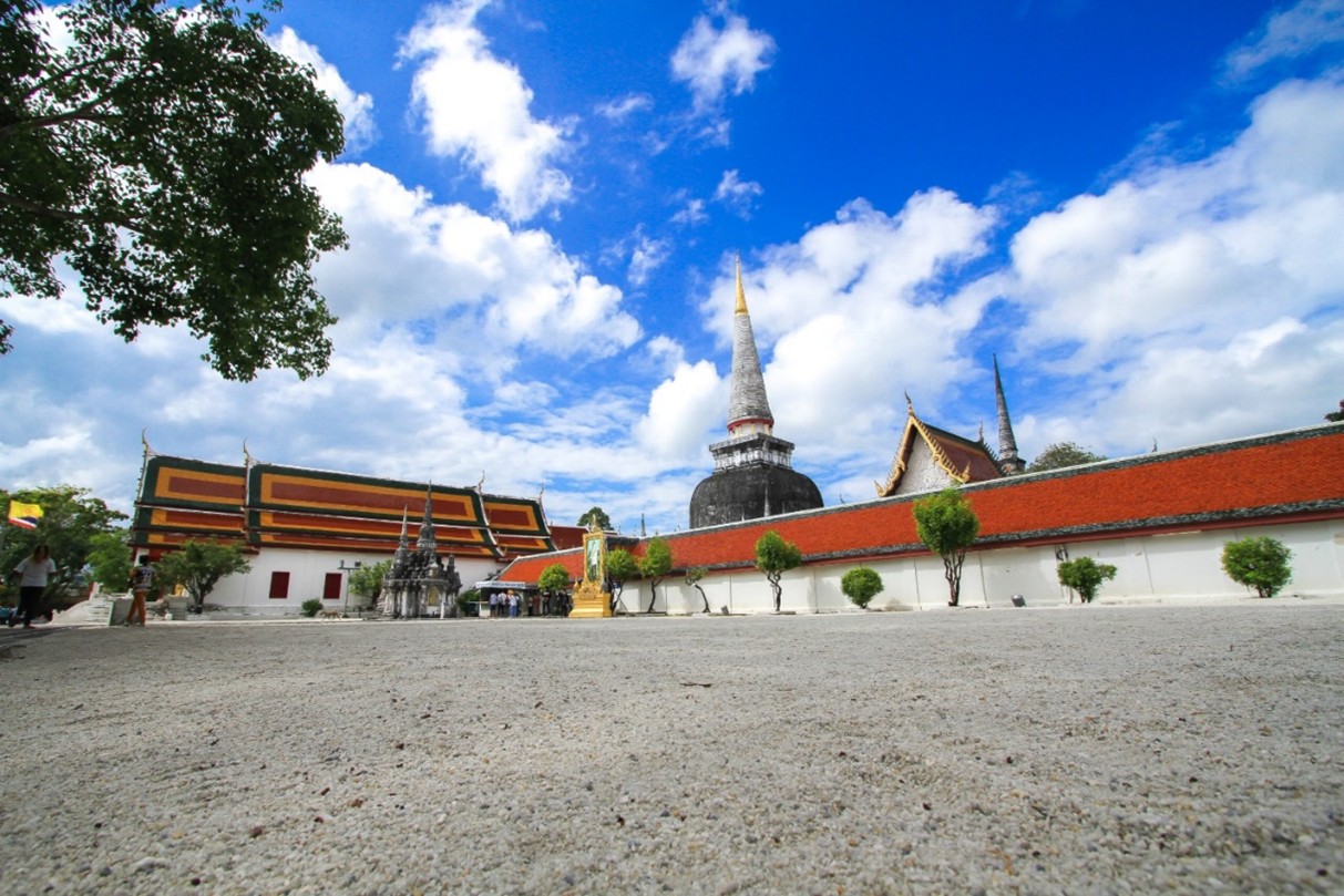
Fig. 2-2 The Sand Ground of the Crystal Beach in front of the Great Reliquary
The property, which is the precinct of Wat Phra Mahathat, is of 5.356 hectares and the buffer zone covers an area of 113.136 hectares, affirming that it has a substantial size. As a living Buddhist monastery, the wholeness of this property has been kept intact by the fact that it has both the sanctuary (Buddhavasa) and residential sections (Sanghavasa) for the monks, authentically instructed in the Tipitaka (the most revered Buddhist scriptures), surrounded by the clear, solid walls of the Monastery and protected by the legislations. The Great Reliquary complex and its surrounding religious buildings, delineated by the inner walls and displaying a high level of authenticity, were at the center of the Monastery, flanked by residential quarters for monks in the north and south. The buffer zone also includes the two old cities and important religious sites associated with the Monastery along the sacred ancient beach ridge.